


Prior Twp. Voting District, Big Stone County, Minnesota
About
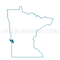
Outline

Summary
| Unique Area Identifier | 601215 |
| Name | Prior Twp. Voting District |
| County | Big Stone County |
| State | Minnesota |
| Area (square miles) | 47.90 |
| Land Area (square miles) | 44.56 |
| Water Area (square miles) | 3.34 |
| % of Land Area | 93.03 |
| % of Water Area | 6.97 |
| Latitude of the Internal Point | 45.43638440 |
| Longtitude of the Internal Point | -96.54720800 |
Maps


Graphs
Select a template below for downloading or customizing gragh for Prior Twp. Voting District, Big Stone County, Minnesota


Neighbors
Neighoring Voting District (by Name) Neighboring Voting District on the Map
- Almond Twp. Voting District, Big Stone County, MN
- Big Stone Twp. Voting District, Big Stone County, MN
- Browns Valley Twp. Voting District, Big Stone County, MN
- Foster Twp. Voting District, Big Stone County, MN
- Graceville Twp. Voting District, Big Stone County, MN
- Toqua Twp. Voting District, Big Stone County, MN
- VTD - precinct 2 Geneseo-Lockwod-GarfieldTwp-CoronaTown, Roberts County, SD
Top 10 Neighboring County Subdivision (by Population) Neighboring County Subdivision on the Map
- Browns Valley township, Big Stone County, MN (358)
- Lockwood township, Roberts County, SD (304)
- Big Stone township, Big Stone County, MN (275)
- Geneseo township, Roberts County, SD (271)
- Prior township, Big Stone County, MN (247)
- Graceville township, Big Stone County, MN (197)
- Foster township, Big Stone County, MN (112)
- Almond township, Big Stone County, MN (110)
- Toqua township, Big Stone County, MN (53)
Top 10 Neighboring Unified School District (by Population) Neighboring Unified School District on the Map
- Milbank School District 25-4, SD (5,743)
- Ortonville -Bellingham Public School District, MN (3,549)
- Clinton-Graceville-Beardsley Public School District, MN (2,587)
- Big Stone City School District 25-1, SD (734)
Top 10 Neighboring State Legislative District Lower Chamber (by Population) Neighboring State Legislative District Lower Chamber on the Map
Top 10 Neighboring State Legislative District Upper Chamber (by Population) Neighboring State Legislative District Upper Chamber on the Map
Top 10 Neighboring 111th Congressional District (by Population) Neighboring 111th Congressional District on the Map
Top 10 Neighboring Census Tract (by Population) Neighboring Census Tract on the Map
Top 10 Neighboring 5-Digit ZIP Code Tabulation Area (by Population) Neighboring 5-Digit ZIP Code Tabulation Area on the Map
- 56278, MN (2,601)
- 57216, SD (1,044)
- 56240, MN (1,042)
- 56225, MN (834)
- 56211, MN (529)
- 57227, SD (434)